Ryukyu Islands
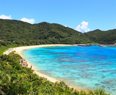
The climate of the islands ranges from humid subtropical climate (Köppen climate classification Cfa) in the north to tropical rainforest climate (Köppen climate classification Af) in the south. Precipitation is very high and is affected by the rainy season and typhoons. Except the outlying Daitō Islands, the island chain has two major geologic boundaries, the Tokara Strait (between the Tokara and Amami Islands) and the Kerama Gap (between the Okinawa and Miyako Islands). The islands beyond the Tokara Strait are characterized by their coral reefs.
The Ōsumi and Tokara Islands, the northernmost of the islands, fall under the cultural sphere of the Kyushu region of Japan; the people are ethnically Japanese and speak a variation of the Kagoshima dialect of Japanese. The Amami, Okinawa, Miyako, and Yaeyama Islands have a native population collectively called the Ryukyuan people, named for the former Ryukyu Kingdom that ruled them. The varied Ryukyuan languages are traditionally spoken on these islands, and the major islands have their own distinct languages. In modern times, the Japanese language is the primary language of the islands, with the Okinawan Japanese dialect prevalently spoken. The outlying Daitō Islands were uninhabited until the Meiji period, when their development was started mainly by people from the Izu Islands south of Tokyo, with the people there speaking the Hachijō language.
Administratively, the islands are divided into Kagoshima Prefecture (specifically the islands administered by Kagoshima District, Kumage Subprefecture/District, and Ōshima Subprefecture/District) in the north and Okinawa Prefecture in the south, with the divide between the Amami and Okinawa Islands, with the Daitō Islands part of Okinawa Prefecture. The northern (Kagoshima) islands are collectively called the Satsunan Islands, while the southern part of the chain (Okinawa Prefecture) are called the Ryukyu Islands in Chinese.